Stavanger Adventure takes you on this guided hike to Topphøna, a spectacular circular route offering breathtaking views and a poignant connection to history.
History, crisp mountain air, majestic vistas, diverse terrain, and picturesque surroundings are some of the highlights of this hike. This hike takes you through a landscape that bears witness to a tragic plane crash in 1961.
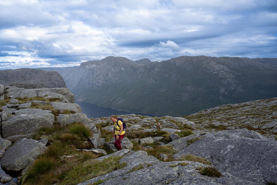
Enjoy sweeping vistas across the Ryfylke region, with Stavanger to the west and Karmøy to the northwest. To the southeast, you'll spot Reinaknuten, a prominent navigational landmark for seafarers. The trail combines both rocky and forested terrain.
Topphøna hike description
You are picked up in Stavanger, starting with a 40-minute car journey to the trailhead at the Holtaheia parking area. During this drive, we traverse the world's longest and deepest underwater tunnel for cars, facilitating a swift crossing of the water expanse separating Stavanger from the hiking trail. A portion of the route takes us along a nearby fjord in the Stavanger region, providing a scenic glimpse of the Norwegian countryside.
Equipment and safety check
Once at the hike's starting point, the guide conducts an equipment check, making any necessary adjustments. Following this, a short safety briefing is provided, covering trail information, expected conditions, and useful hiking tips before embarking on today's exciting adventure!
Two alternative routes from the Holtaheia parking area
The adventure starts at the Holtaheia parking area. This trail offers two alternative routes to the destination at the edge of Topphøna. We usually turn this hike into a roundtrip by taking the eastern route first, which passes by the memorial site. After a bit of ascent and descent, you'll reach a trail junction where you can include a short detour to an observation point at around 532 meters above sea level. From here, you can peer down at your destination, Topphøna.
The Topphøna peak grants you splendid views of Tysdalsvatnet, Vatne camping, and Bjørheimsbygd. On the return, following the western route, you also have an opportunity for a side trip to another viewpoint at approximately 458 meters above sea level. If you wish for an easier hike, you will take the western route in both directions. This choice is an easier adventure than the round trip.
History of the Holtaheia accident plane crash
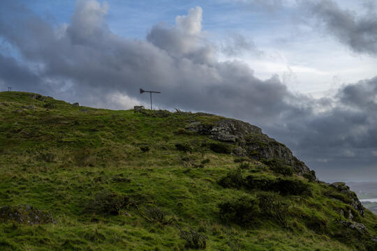
On this hike, you'll get up close and personal with history as you explore the remnants of the crash. The "Holtaheia Accident" occurred on August 9, 1961. The flight was transporting an entire school class from Croydon, a district in south London. The crash was a result of the pilot's decision to deviate from the planned flight path for unknown reasons.
Tragically, 34 boys aged 13 to 16, along with two teachers, lost their lives in the accident, in addition to the three crew members. Never before had so many children perished in an aviation accident.
Memorial at Holtaheia
A memorial honouring the 39 lives lost in the accident was unveiled at Holtaheia on May 13, 1962. Today, this area is a popular hiking destination, and scattered remains of the plane can still be found across the expansive landscape.


